Skip menu to read main page content

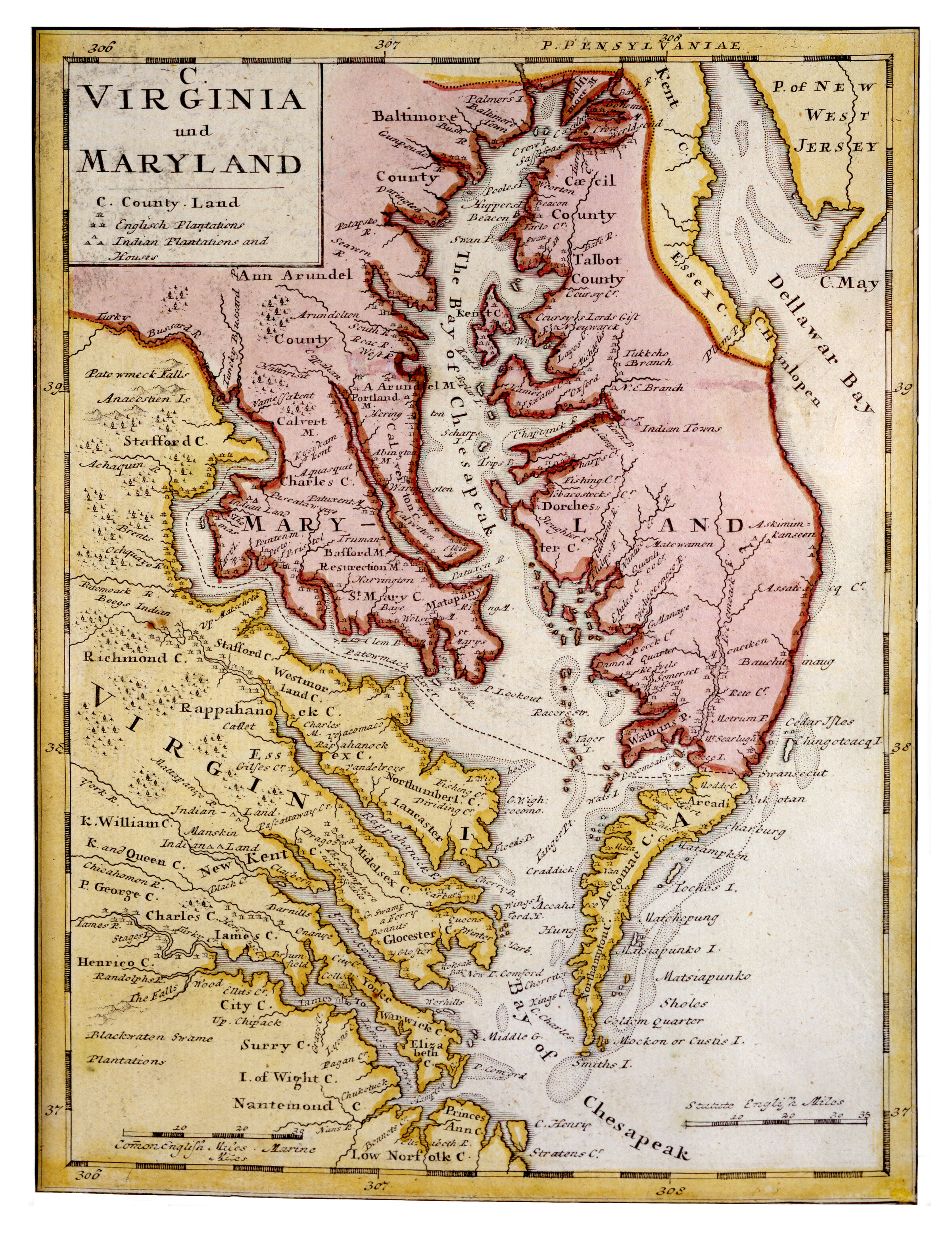
Virginia und Maryland

Description

Hand colored, engraved map depicting the areas of Virginia and Maryland that border the Chesapeake Bay as they were known in 1736. Parts of Delaware and New Jersey are also visible. A key beneath the map title shows symbols indicating "English Plantations" and "Indian Plantations and Houses."

Date

circa 1737

Contributor(s)

Contributor(s) Notes

Engraver: Johann Baptist Homann
Cartographer: Herman Moll

Publisher

Homann Erben (Firm)

Language(s)

Dimensions

8 x 10.5 inches

Extent

1 map

Resource ID

3996

Notes

This is one out of four hand-colored maps featured on a single sheet entitled "Dominia Anglorum in America Septentrionali [and] Die Gros-Britannische Colonie-Lander in Nord America." They are based upon individual maps from cartographer Herman Moll’s "Atlas Minor" (1729).

Digital Publisher

Digital resource provided by the Maryland Center for History and Culture

Rights

This digital image is made available here for private study, scholarship, and research. Commercial and other uses are prohibited without the permission of the Maryland Center for History and Culture. For more information, visit the MCHC’s Reproductions and Permissions web page.