Skip menu to read main page content

This plan of the city of Baltimore

Description

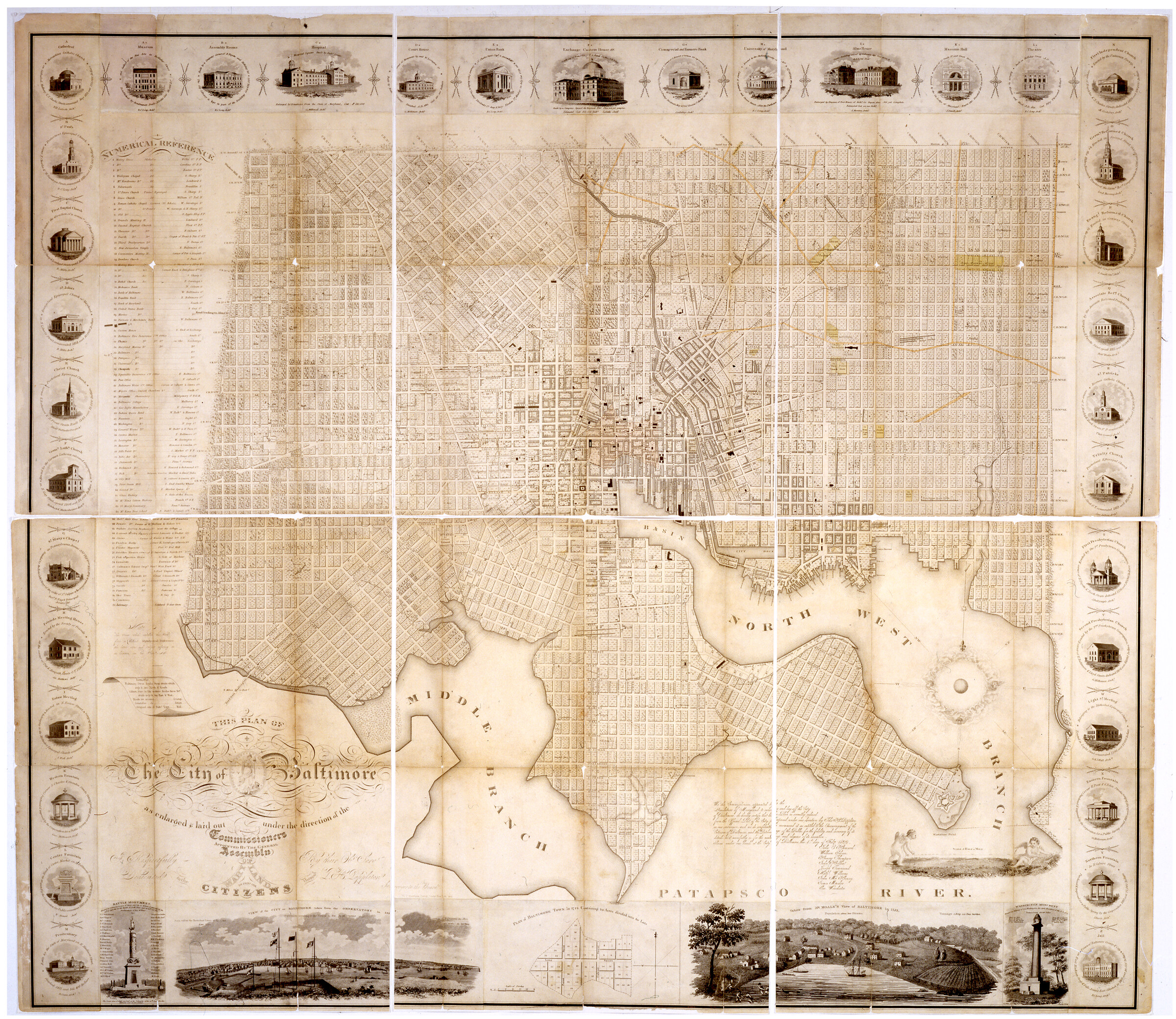
This 1822 map of Baltimore was created from Thomas H. Poppleton's survey and engraved by Joseph Cone. Its central section showing actual as well as proposed streets, includes locations of buildings and landmarks identified by a numbered key. The plan is surrounded by engraved views of the city, including monuments, fountains, and a 1729 plan.

Date

1822

Contributor(s)

Contributor(s) Notes

Surveyor: Thomas H. Poppleton
Engraver: Joseph Cone

Language(s)

Dimensions

109.9 x 125.7 cm

Extent

1 map

Resource ID

3732

Digital Publisher

Digital resource provided by the Maryland Center for History and Culture

Rights

This digital image is made available here for private study, scholarship, and research. Commercial and other uses are prohibited without the permission of the Maryland Center for History and Culture. For more information, visit the MCHC’s Reproductions and Permissions web page.